Waiguru bets on technology to fix Kirinyaga’s land mess

Kirinyaga Governor Anne Waiguru. Photo credit: Women in leadership
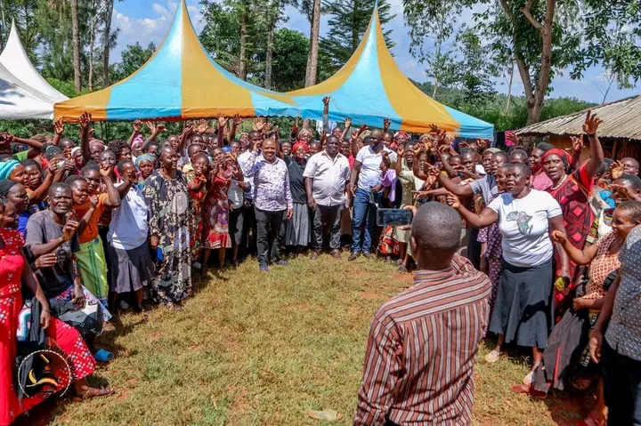
Kirinyaga Governor Anne Waiguru has launched a phased geo-referencing and digital land mapping exercise across major urban centres in the county, capturing precise GPS coordinates for every plot to build a tamper-proof land registry.
The exercise, now in its second week in Kutus and Kagio, will extend to Wang’uru, Kianyaga, Kerugoya, Baricho and Sagana. Officials say the programme will resolve long-standing ownership disputes, clamp down on double allocations and improve county urban planning and revenue collection.
Protecting public land at the centre of development
“Safeguarding public land from being grabbed is important because such land is meant to serve the collective good, not private interests,” Waiguru said, linking the initiative to broader goals of infrastructure, housing and environmental conservation.
The Lands Cabinet Executive Committee Member, Rev. Samuel Kanjobe, told residents the drive had exposed a fundamental data problem. County registers listed more than 23,000 plots, yet fieldwork showed the number did not match actual plots on the ground. The pre-mapping exercise is now establishing an accurate physical count to reconcile the discrepancies.
A legacy of gaps left by defunct authorities
Kanjobe said many anomalies trace back to administrative gaps left by defunct local authorities. In several towns, land had been acquired for expansion and original owners compensated with alternative parcels in Mwea-area settlements, but surrender of old title deeds was never completed. Some residents still hold only meeting minutes from former councils as proof of ownership — a reality the mapping drive aims to correct.
The initiative complements an earlier Geographic Information System laboratory established with support from the Food and Agriculture Organization of the United Nations at Kirinyaga county headquarters in Kutus.
Over 800 acres of grabbed land already recovered

Since taking office, the Waiguru administration has reclaimed more than 800 acres of grabbed public land valued at approximately KSh 1 billion — parcels reserved for schools, hospitals, police stations, markets and dams. Verified digital records will make future encroachments far harder to sustain.
Residents welcome the exercise as long overdue
Reception in Kutus has been largely positive. Elder Mugo Murage said residents were properly briefed before teams arrived. “This exercise was long overdue,” he said. Fellow elder Johnston Gitau Njoroge added that surveyors had already generated spatial data that could guide planning of a sewerage system for Kutus town.
Related Articles